Welcome to KGLOBE SOFTTECH INDIA PRIVATE LIMITED, We provide high quality and accurate data on the following services. Mostly our advanced LiDAR sensor service is popular in market.
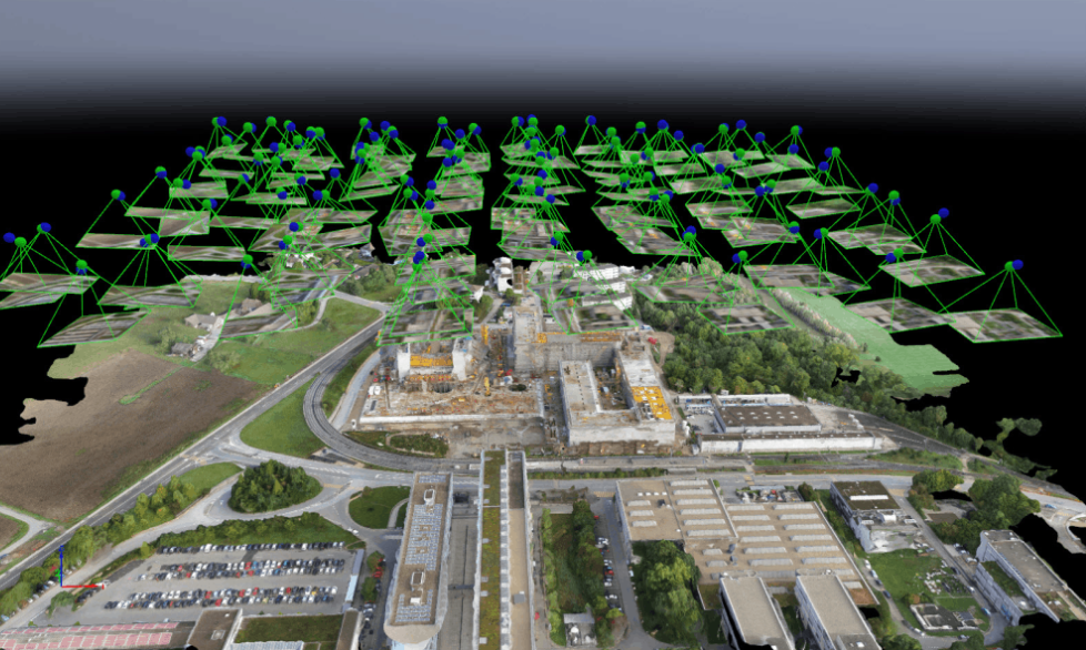
lidar is a method for measuring distances or range and light detection by illuminating the target with laser light and measuring the reflection with a sensor.Lidar is commonly used to make high-resolution maps, archaeological, geographical, forestry,and many industrial fields.Sometimes it called “laser scanning” or “3D scanning.The technology uses eye-safe laser beams to create a 3D representation of the area
view details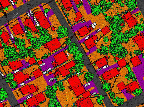
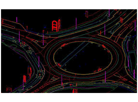
Mobile mapping technologies are being used to enhance specific mapping tasks,Mobile mappers are devices that collect geospatial data from a mobile vehicle.This Mapping Systems are the combination of various navigation and remote sensing technologies on a common moving platform, which capable of providing fast, efficient and complete data collection.
view detailsAn orthophoto (also known as a orthophotograph) is commonly used in geographic information systems (GIS) as a "map accurate" background image. Orthophotos are corrected to remove terrain effects and distortions that result from the camera’s lens and the angle the photo was taken from the plane or drone.
View All Services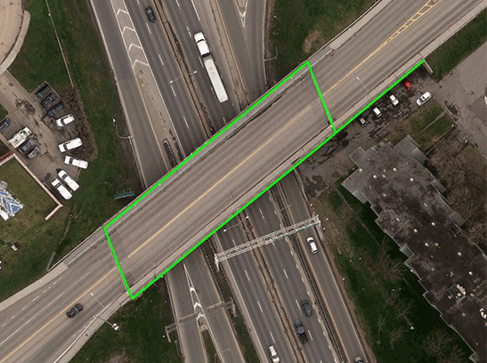
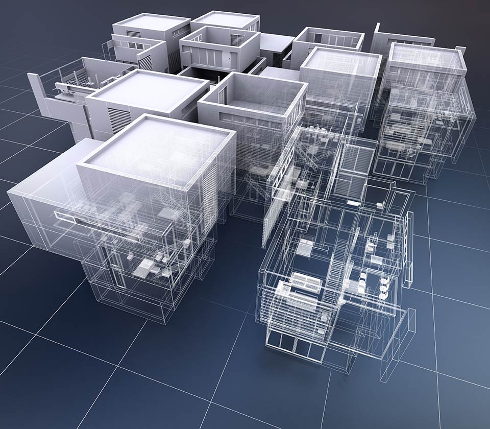
We create exceptionally accurate 3D models of brownfield facilities – rapidly and cost effectively. Our 3D scanning capabilities dramatically reduces the field time required to accurately as-build a facility. Compared to the traditional method of marking up old P&IDs and Plots Plans (if they are available) and taking hand measurements, 3D scanning allows the digital information to create a point cloud image which can be directly converted to a 3D model.
view detailsOur Digital photogrammetry Department have the exprience employees who use computers to obtain the measurements of objects in a photograph. It typically involves analyzing one or more existing photographs or videos with photogrammetric software to determine spatial relationships. To achieve completeness and accuracy of each project, Geodraft uses specific quality control to meet client needs. View All Services
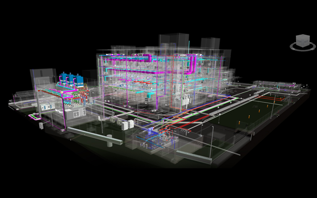
BIM services or searching for BIM outsourcing company, we would like to communicate that we are having complete knowledge in providing a full range of BIM services, along with its different levels of developments, and stages that is from 3D BIM services to 7D BIM services.
Now, when talking about the services when the clients demand to have the complete 360-degree view of BIM models we do provide the access to it by implementing all the various stages and LODs' that are required.
view detailsWe offer web design & development service around the Globe. Your website represents your business. We see your business through the eyes of your customers to render websites that reach out to them at the first glance.With experience combined with a fluent understanding of key modern web concepts means that we can build a custom, enterprise-grade solution to meet every need and handle your most complex business challenges, smoothly.
View All Services